
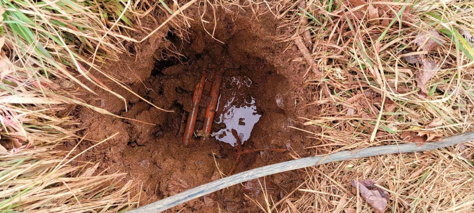
Nobody maps a buried utility perfectly. Paint on the pavement from a one-call locate shows where a line probably runs, within a tolerance, along the path the locator could trace. It does not show depth with any confidence, it does not show a line that carries no signal, and it does not show the abandoned pipe that someone forgot to record. Potholing is the practice of digging a small, controlled hole with vacuum excavation to see the line itself, measure its depth and size, and confirm its position before the trench crew arrives.
We pothole and locate as the first step on utility, foundation and paving projects. A potholing crew with a vacuum truck exposes a line in an hour, records its elevation to survey control and backfills the hole, leaving the owner a coordinate and a depth instead of a guess. That number becomes the basis for every design change that follows, and it is usually the cheapest information on a project.
Locating, exposing and recording
Our scope begins with a records review and a one-call notice, then a field locate using electromagnetic equipment and ground penetrating radar where it is useful. Radar picks up pipes that carry no signal, such as clay, concrete and plastic lines without tracer wire, though its depth and clarity vary with the soil. We mark what we find and note where the readings are doubtful.
Vacuum excavation then exposes the line at the points the engineer needs: crossings, tie-ins, connection points and areas of conflict. The truck uses air or water to loosen soil and a vacuum to remove it, leaving the utility undisturbed. We measure the top and bottom of the pipe, record the material and size, and survey the position. Holes are backfilled and compacted, and the surface is restored or temporarily patched, so the potholing does not leave a hazard. The results go into a table with coordinates and elevations that the designer can use directly.
Why we pothole before we trench
It is cheaper to find a line with a vacuum truck than with an excavator bucket. A strike on a gas main or fiber trunk can mean an evacuation, a lawsuit and weeks of delay, and the cost of the hole is small by comparison. We therefore pothole every crossing and every point where the design depends on a known elevation, particularly where a new gravity line has to pass over or under an existing one with little vertical room.
The information also improves the design. If a pothole shows an existing line two feet deeper than the drawing, the engineer can adjust the new line before pipe is ordered. If it shows an unrecorded conduit, the alignment can shift on paper. Because the team that builds the trench afterward receives the actual findings and the markings, and we avoid the common handoff problem where a separate locating firm's report never reaches the foreman.
Where the ground is crowded
Congested corridors are the hardest places to locate. In the Eagle Ford Shale region, which the Dallas Fed describes as an arc across 20,000 square miles of South Texas, gathering lines, water lines, power and fiber cross rural land in patterns that few records capture, and the owners are often multiple operators. In the Eagle Ford belt, a pothole is often the only way to find a line that was installed quickly and mapped loosely.
Rail corridors add another layer. Reports describe the BNSF Conroe subdivision and the Union Pacific line north from Houston crossing at a diamond in downtown Conroe, and the Union Pacific intermodal facility in Mesquite sits within the Skyline Industrial Park. Near rail, signal and communication cables run parallel to the track, and the railroad requires its own flagging and permits before anyone digs. We coordinate with the railroad's inspectors and use hand tools or vacuum methods inside their right of way.
One-call, tolerance zones and standards
Texas law requires an excavator to notify the state one-call system before digging, and the member utilities respond by marking their lines within a set time. The marks establish a tolerance zone on each side of the line within which mechanical excavation is restricted. We respect those zones and use vacuum or hand digging inside them. Private lines, such as those serving a plant or a campus, are often not covered by the one-call and require a separate locate by the owner or a private firm.
Many owners now require a formal subsurface utility engineering report, graded by quality level, which describes how each line's position was established. A pothole is the highest quality level, because the line has been physically seen and measured. For utilities and energy companies and public agencies, we provide the report format the owner specifies, with each pothole photographed and mapped.
What potholing protects
Almost every scope we build benefits from it. Utility relocation depends on knowing exactly what is being moved. A new water main or sewer line needs to clear existing crossings. Duct banks, conduit routes and foundations near live lines all need it, as do drilled pier locations where a hit would be costly.
On a development with a mix of old and new infrastructure, we sometimes carry out a full utility investigation before design is finished, so the engineer works from field data. The extra few days at the front end have saved owners much more than they cost, and they give us a sounder base for the schedule.
How potholing fits the project calendar
The one-call notice carries a waiting period before work can start, so potholing needs to be requested early. We schedule locates and potholes as soon as the survey is available and before the trench crew is mobilized. A day or two of potholing can often be done ahead of notice to proceed if the owner authorizes early investigation.
Weather and soil affect production. Water-based vacuum systems struggle in freezing weather, and dry air systems are slower in heavy clay. We choose the method for the season and the soil, and we plan the restoration so open holes never stay open overnight without cover or barricades. The result is a table of verified utilities delivered in time for the engineer to use it.
Find the lines before you dig
Send the utility plan and the list of crossings and we will propose the potholes, the survey and the report format the owner needs.
Common Questions
Does a one-call locate show the depth of the line?
Not reliably. Locators mark the horizontal position and sometimes give an approximate depth, but depth readings can be off by a wide margin. A pothole exposes the line and measures the true depth, which is why it is used when elevations matter.
What is vacuum excavation?
Vacuum excavation uses pressurized air or water to break up soil and a vacuum to remove it into a tank. It exposes buried utilities without striking them. The hole is small, usually a foot or two across, and is backfilled after the line is measured.
Can potholing find unmarked or abandoned lines?
Ground penetrating radar and electromagnetic tools can detect many, but not all. Potholing at suspect locations confirms them. No method is perfect, which is why we still use hand digging and caution during trenching even after the investigation.
How many potholes does a project need?
It depends on the design. Typical locations are every crossing, every tie-in and at intervals along a corridor where a conflict is likely. The engineer usually specifies the list, and we recommend adding extra holes where a mistake would be costly.
Who is responsible if a line is hit despite locating?
Responsibility depends on the contract, the accuracy of the markings and whether the excavator followed the rules. Following the tolerance zone and using vacuum methods inside it is the best protection for everyone. We document each step so the record is clear.